5 Takeaways From Philly’s New Anti-Congestion, Pro-Transit Plan
CONNECT might be the city’s widest-ranging proposal ever to tackle its transportation issues — including bike lanes, traffic congestion, public transit, and more. We’ve broken it down for you.
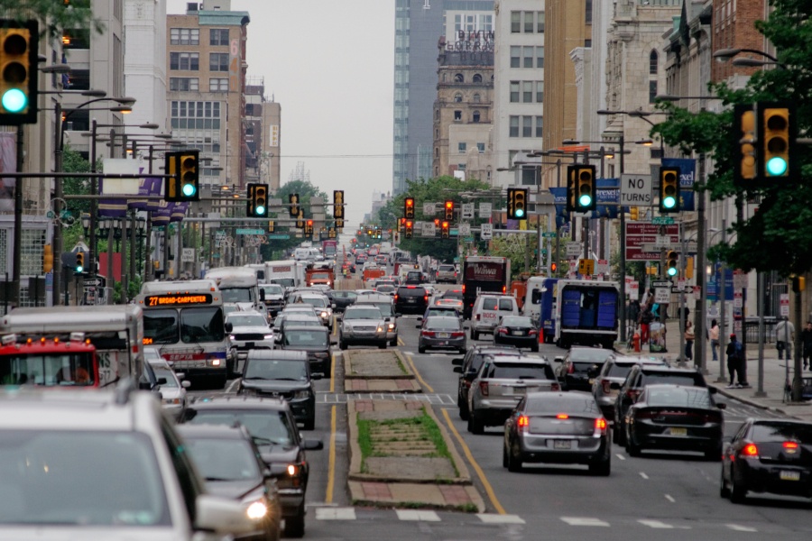
CONNECT, the city’s new strategic transportation plan, aims to cut down on Center City traffic congestion over the next seven years. | Photo by Bastiaan Slabbers via iStockphoto.com
The city just revealed its first ever “strategic” transportation plan — a lengthy report that includes recommendations for increasing safety and efficiency on Philly’s streets, at a time when residents regard the city’s streetscape as congested, pothole-ridden, and dangerous.
The plan, CONNECT, differs from other long-term transportation proposals — like the City Planning Commission’s recently released Philadelphia2035 or Vision Zero, for example — in that it’s an effort to set transportation priorities over the next seven years while guiding city departments to work with stakeholders on those goals.
Below you’ll find our five takeaways from the report, which you can read in its entirety right here.
1. CONNECT prioritizes plans to revamp the city’s bus network.
The report notes declining bus ridership in Philly, as well as worsening on-time bus performance amid increased traffic congestion, and strengthens previous calls to redesign the city’s bus network.
For the most part, CONNECT points to SEPTA’s Philadelphia Bus Network Choices Report, released earlier this year. That plan includes strategies to decrease bus route duplication and excess service, as well as install bus shelters, maintain and transform existing bus lanes, and better prioritize bus service as a viable means of transportation.
Overall, goals listed in the new report include:
- Increasing bus speed by 5 percent
- Improving current bus facilities on Chestnut Street and Market Street
- Partnering with PennDOT and SEPTA to implement dedicated bus facilities along Roosevelt Boulevard
- Piloting real-time bus arrival information and displays
- Completing the installation of more than 600 city-owned bus shelters
- Working with SEPTA to implement an improved bus network by the end of 2025
In addition, the report includes plans to modernize the city’s trolley fleet — as previously proposed — and begin the construction of new trolley lines and streetscape improvements by the end of 2025.
#ConnectPHL, our new strategic transportation plan, will guide us in creating a system that works for everyone. In a city with a 26% poverty rate, we must provide opportunities, not challenges. Connect does this by prioritizing transit, walking & biking ➡️ https://t.co/Sqg5CqoCy3 pic.twitter.com/TQ4loK8xOo
— Mayor Cherelle L. Parker (@PhillyMayor) October 10, 2018
2. To make transportation more equitable, CONNECT aims to improve public transit overall.
CONNECT calls on both city officials and SEPTA to “ensure that public transit is the first travel model of choice.”
The plan notes that Philadelphians are highly reliant on public transit: 40 percent of residents get to work without a car, most of whom use transit — and these residents tend to be poorer and disproportionally minority, according to the proposal.
Officials call for plans to make public transportation more efficient and equitable, largely through improving the bus network (as mentioned), expanding the Indego bike share, and increasing public transit ridership overall. Plus, they’re recommending the creation of a citywide transit plan — a way to better prioritize the use of road space — by the end of 2020.
Transit proposals listed in CONNECT include:
- Increasing transit ridership in Philadelphia by 10 percent vs. the national trend by 2025
- Increasing the number of riders in the city served by bus shelters from 32 percent to 40 percent
- Increasing bike-share trips by 100 percent — and those taken by minority or low-income populations by 120 percent
- Ending SEPTA’s “transfer penalty”
- Extending the Broad Street line to the Navy Yard
- Encouraging universities and businesses to use transit pass programs for students and employees
- Producing a city transit plan by 2020
3. Officials want to find new ways to cut down on frustrating traffic congestion.
CONNECT notes that, on one hand, traffic congestion is a sign of a booming, “competitive” city. On the other hand, that growth density leads to traffic gridlocks in Center City and University City, as well as in some neighborhoods along the Broad Street Subway and Market-Frankford Line.
Philadelphians now have more cars than ever: 68,000 more in the last eight years alone, according to the plan. We spend roughly 48 hours in traffic per resident per year (which, compared to other major cities, is actually not that long).
To manage congestion, the city is looking to increase traffic enforcement by raising fines for congestion-causing behaviors, shifting delivery times, prioritizing efficient modes of traffic (buses and subways move more people than cars do), and better managing traffic patterns.
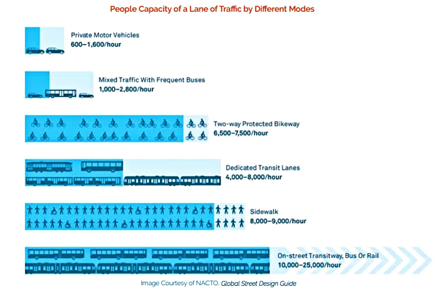
Image via CONNECT/OTIS
Here’s what CONNECT suggests moving forward:
- Updating fines and fees for parking (including potential price increases) by 2020
- Improving management of curbside deliveries
- Securing new locations for truck owners/operators to park their trucks overnight
- Working with the Philadelphia Parking Authority and the police department to direct truck drivers to available parking locations
4. CONNECT aims to increase bike ridership.
Roughly 2.6 percent of Philadelphia residents currently commute to work via bike — which might sound small, but it’s one of the largest commute shares of the nation’s major cities. Officials see potential for to double to at least 4 percent by 2025.
They aim to achieve this goal by:
- Establishing 40 miles of protected bike lanes in the city by 2025, so residents feel more comfortable biking.
- That includes protected bike lanes on Spring Garden Street (between Delaware Avenue to Eakins Oval) and on Washington Avenue (between Grays Ferry and Delaware avenues).
- Increasing the percentage of residents living within a quarter mile of a protected bike lane or trail from 16 percent to 28 percent by 2025.
- Creating bicycle network facilities on
- JFK Boulevard (between 15th to 20th streets)
- Market Street (between 15th to 30th streets)
- Race Street (between 8th and 6th streets)
- Torresdale Avenue (over Pennypack Creek)
- Parkside Avenue (Girard to Bryn Mawr avenues)
5. The plan stresses a need to ramp up a regional funding plan for transit programs and renovations.
Philadelphia has a comparatively low contribution of regional funds to public transit — just 11 percent (compared to 41 percent for Boston, 42 percent for Washington, D.C., and 60 percent for New York City).
State funding for SEPTA is expected to fall significantly in accordance with changes in Act 44 funding, with “serious state of good repair implications for the Philadelphia region,” the plan states.
The plan calls for officials to collaborate on a regional plan for transit funding with the state, SEPTA, neighboring counties and other potential community and business partners moving forward. Otherwise, CONNECT, in its entirety, could become far less realistic.