PennDOT Launches Website for DNC Travel
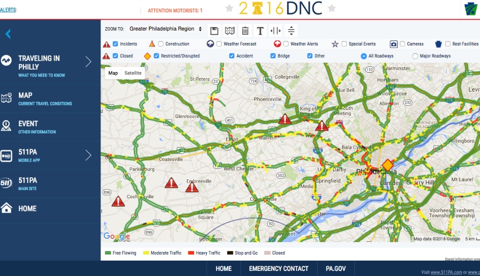
A screenshot of PennDOT’s travel map.
The Pennsylvania Department of Transportation has launched a website that will help residents and visitors navigate the city when the Democratic National Convention and its projected crowd of 50,000 flood the town this month.
“The convention will bring thousands of delegates, media and visitors to Philadelphia and this site will help everyone keep on top of changing traffic conditions and information about street closures and restrictions,” Governor Tom Wolf said in a statement. “As we did with last year’s Papal visit, my administration has worked very hard to assist travelers during this important national event.”
The website will offer DNC travel information regarding traffic conditions on highways and streets as issues unfold. It includes a list of closures planned for the convention, specifically in South Philadelphia near the Wells Fargo Center, where many DNC events will occur.
The PennDOT page also details alternate routes to drivers who wish to avoid traffic (as much as possible).
“We want to keep inconvenience to our visitors and residents alike at a minimum during the DNC, and this tool is one way they can become aware of changing traffic conditions,” PennDOT Secretary Leslie S. Richards said in a statement.
The website, www.511pa.com/DNC, is live and providing information on current traffic and closures.
Follow @ClaireSasko on Twitter.