PHOTOS: Schuylkill River Near Flood Stage After Monday’s Heavy Rains
The water level has prompted road closures in Manayunk — where the risk of flooding is highest.
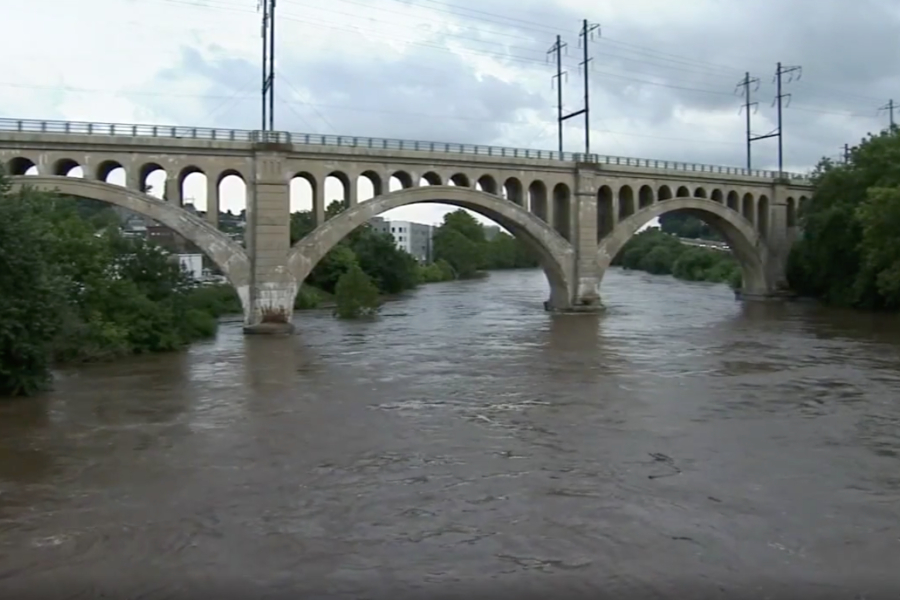
Image via 6ABC Action News
The torrential downpours that flooded parts of the region on Monday have prompted the Schuylkill River to rise near flood stage.
According to the National Weather Service, the river rose to 10.92 feet on Monday night — just shy of 11 feet, which is considered flood stage.
6ABC reports that the high water level is worrying some residents and business owners in East Falls and Manayunk, where the risk of flooding is highest. It’s also affecting roads in the area: Main Street in Manayunk is closed from Ridge Avenue to Leverington Street (flooding extends into Shurs Lane); the Route 1 off-ramp to Ridge Avenue is flooded and closed; MLK Drive is flooded and closed between Greenland Drive and Montgomery Drive; and Kelly Drive is flooded and closed between Hunting Park Avenue and Falls Bridge (the Flat Rock area is flooded), as well as between North Ferry Road and Falls Bridge.
.@bcgp #cyclist rides around flooded #schuylkill river in #philadelphia #philly during morning ride Tues. after heavy rain caused river to overflow its banks. #streetphotography #bicycle #bike pic.twitter.com/d0exm6vOR8
— Alejandro Alvarez (@PhillyRover) August 14, 2018
The good news? The water level is expected to go down from here. It’s also not nearly as bad as it has been before: On October 4th, 1869, the river reached 17 feet in the Philadelphia area, according to the NWS. That was during the worst flood in the Schuylkill’s history, after the “Saxby Gale” hurricane brought days of rain that ended a summer-long drought.
The current Schuylkill River flooding situation is worse in Norristown, where the river reached 15 feet on Monday night and continues to hover around 13 feet (considered flood stage) on Tuesday morning. Flooding in the nearby area was particularly bad on Monday, affecting a significant portion of the King of Prussia Mall (including a parking garage, where one woman had to be rescued). Pennsylvania 320 between Upper Gulph/Old Gulph and Arden roads remained closed on Tuesday morning.
To check if flooding is still affecting roads near you, visit 511pa.com. Weather.gov also offers an interactive map that allows you to see if a creek or river near you is in danger of flooding.
The Schuylkill river cresting its banks! #Philly @MikeFOX29 @AlexHolleyFOX29 @FOX29philly pic.twitter.com/sjfF3YM7Dn
— Gpaws (@SenorGpaws) August 14, 2018
Otherwise, the worst may be over, but we’re still in for some rain on Tuesday. Showers and thunderstorms are most likely between 4 and 5 p.m. on Tuesday (during the evening commute) and again before 11 p.m., according to the NWS. But new rainfall amounts are less than a tenth of an inch — expect for high amounts possible in thunderstorms.
Then we’re back to sun on Wednesday (hallelujah).
https://twitter.com/DinoDeBiasio33/status/1029312643746750464
WHOA. The Schuylkill River rose to nearly 11ft this morning. The current going over the falls at Boat House Row is intense. But even more shocking is all the trash accumulating behind the @philamuseum and Water Works. I think I counted 30 basketballs in there! @phl17 pic.twitter.com/mxQltVfFkQ
— Matt Alba (@MattAlbaMedia) August 14, 2018