Apple Picks Philly to Debut New Transit App
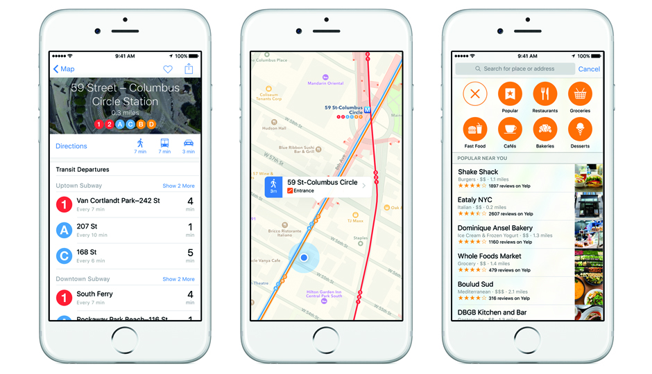
Screen shots of the new Apple Transit, set to debut soon in Philly.
Apple has chosen Philadelphia and nine other North American and European cities to debut its new Transit app, which is basically Apple Maps but for public transportation. It provides step-by-step directions across multiple modes of transportation like buses, trains, subways and walking.
It’s debuting simultaneously in Baltimore, Berlin, Chicago, London, Mexico City, New York, San Francisco, Toronto, and Washington, D.C. It will also be available in 300 cities in China. (Yes, 300.)
“With Transit, we provide a map that emphasizes all the different transit lines — buses and trains, subways stations and so forth,” said Apple’s software vice president Craig Federighi on stage at Apple’s Worldwide Developers Conference. “And when you tap on a station, you can see all the lines that run through it.”
But underground subway stations are huge, and Federighi said that Apple has taken “special care” to identify where a user actually is to give them directions with the precise number of minutes it will take to get from place to place.
“We carefully surveyed all the entrances and exits, so we can give you walking directions based on the time to travel from where you actually are,” he said. “This not only saves you a ton of walking but it also probably is the difference between catching your train on time and being stuck.”