Here’s a Brand-New Map of All of Philly’s Bike Lanes
Courtesy of the Philadelphia City Planning Commission
Navigating for bikers just got a little bit easier.
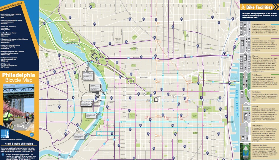
For the first time since 2014, the Philadelphia City Planning Commission released a new map of Philly’s bike lanes, and it’s got every bike lane (buffered and conventional), bike trail, bike route, bike share station, sharrow and “conflict zone” you need to know about. It’s available to download here.
What’s a sharrow, you ask? Sharrows are those painted arrows and bike symbols on the road indicating that cars must share the road with bikers. City officials say bikers can feel free to take up the entire lane on roads with sharrows.
Conflict zones are areas dashed with green paint, where the paths of bikers and cars might dangerously intersect.
The planning commission’s current map also offers gray lines that highlight “suggested connections,” or roads that the city recommends bikers use to navigate between streets with bike lanes. The map also offers tips on safety and what to do if your bike is stolen or you’re involved in a crash.
When the last Philly bike lane map was released, it was before the Indego era and before the city got a $500,000 grant to build more protected bike lanes.
Follow @ClaireSasko on Twitter.