
Winter Storm Warning In Philadelphia Area Until Midnight Sunday
We can sort out who is to blame for the forecast fail and road nightmare another time. For now, it’s safe to say that you shouldn’t go anywhere unless you absolutely have to. I just got back from a harrowing 3-mile round trip drive from Overbrook to Upper Darby that took me an hour, and I saw multiple buses and cars that appeared to be disabled. One driver on 476 tells me that she can’t go above 10 mph without sliding all over the road.
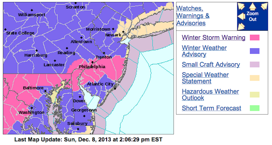
The latest from the National Weather Service is that the Philadelphia area is under a Winter Weather Warning until midnight on Sunday.
From the NWS:
…WINTER STORM WARNING IN EFFECT UNTIL MIDNIGHT EST TONIGHT…
THE NATIONAL WEATHER SERVICE IN MOUNT HOLLY HAS ISSUED A WINTER
STORM WARNING FOR SNOW, SLEET AND SOME FREEZING RAIN, WHICH IS IN
EFFECT UNTIL MIDNIGHT EST TONIGHT. THE WINTER WEATHER ADVISORY IS
NO LONGER IN EFFECT.* SNOW AND SLEET ACCUMULATIONS…3 TO 6 INCHES.
* ICE ACCUMULATIONS…AROUND A TRACE.
* TIMING…SNOW WILL OVERSPREAD THE AREA INTO THE EARLY AFTERNOON
HOURS AND IT MAY BECOME HEAVY FOR A TIME. THE SNOW WILL MIX WITH
SLEET DURING THE EVENING FROM SOUTHEAST TO NORTHWEST… THEN
CHANGE TO RAIN DURING THE OVERNIGHT. THERE SHOULD SOME FREEZING
RAIN FOR A BRIEF TIME DURING THE TRANSITION PERIOD THIS EVENING.* IMPACTS…SLIPPERY TRAVEL WILL DEVELOP ON UNTREATED ROADWAYS.
BRIDGES AND OTHER ELEVATED SURFACES TEND TO ICE UP FIRST.* VISIBILITIES…BELOW 1/2 MILE AT TIMES.
* TEMPERATURES…IN THE UPPER 20S TO AROUND 30 DEGREES.
PRECAUTIONARY/PREPAREDNESS ACTIONS…
A WINTER STORM WARNING MEANS SIGNIFICANT AMOUNTS OF SNOW…
SLEET…AND ICE ARE EXPECTED OR OCCURRING. STRONG WINDS ARE ALSO
POSSIBLE. THIS WILL MAKE TRAVEL VERY HAZARDOUS OR IMPOSSIBLE.