The Best Thing That Happened This Week: Google Trekker Is Wandering Our Woods
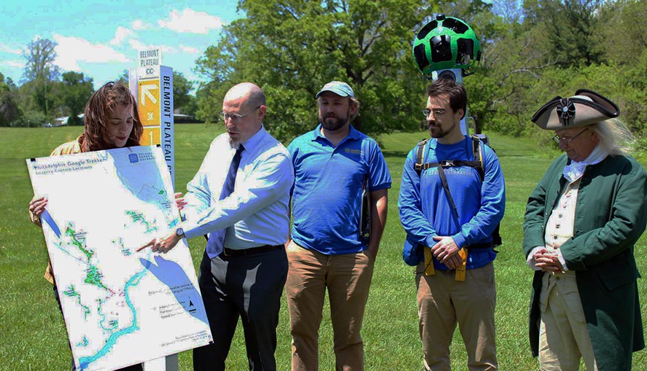
Photo | Facebook

The Trekker backpack. Photo | Google
On Monday, city officials announced that Philadelphia is the first city ever to try to catalog its park system for Google Street View. Two strong guys, Conor Michaud (he’s a gym instructor) and Gint Stirbys (he’s a mover), are wandering the woods, fields and streams of all 63 city parks — 200 miles of trails stretching over 9,000 acres — wearing a 50-pound Google Trekker backpack with 15 cameras mounted overhead to digitally document their way. (Google provided the backpack gratis, and Michaud and Stirbys are making $15 an hour for their pains.) The pair set out at nine in the morning and walk until three to catch the best light for the cameras, which snap panoramic shots every three seconds. They take turns; one wears the camera while the other clears obstacles and litter from the trail (so it’ll look real nice). They have the camera through November 1st; parks and rec geographic information systems specialist Nora Dougherty has already mapped out their schedule. It’s a lot of walking. But as Tim Clair, interim executive director of the Fairmount Park Conservancy, said at Monday’s press conference, “There are so many treasures in the parks that people never get to see.” This is gonna be so cool.
Follow @SandyHingston on Twitter.